Maps lie. More than we think they do.
Absolutely all world maps are deceptive because of maths. To represent the 3D spherical shape of the Earth on a 2D flat piece of paper, one would necessarily distort at least one of the parameters, be it size, distance, scale, or position. The choice of what must be kept as precise as possible and what can be sacrificed will often depend on the map’s purpose. Is it for land or marine navigation? For exploration, measurement, information? For teachers, tourists, drivers?
And whatever the target is, there’s always space for persuasion or cartographic propaganda, which a map author can use on their own initiative or upon somebody else’s request to convey specific, often subjective ideas. The concept might sound like something relatively new, while it appeared together with the first world maps – so yes, somewhere in the Middle Ages.
Ideas they support or oppose
This is probably the most interesting aspect which, in addition, can be extremely broad. Maps can either explicitly or implicitly point to territorial pretensions, relations between countries, national ideologies, spheres of influence, regional inequalities, to name a few.
By the nature of the issue, this type of propaganda will be, first of all, noticeable to the affected regions and groups of population but will likely cause no suspicion or doubts in the back of the mind of a stranger. It will quickly convince one that the proposed picture of the world is "corrrect".
The map below was created in 1718 by a French cartographer Guillaume Delisle, known for his detailed and precise works. Can you see anything wrong or provocative here?
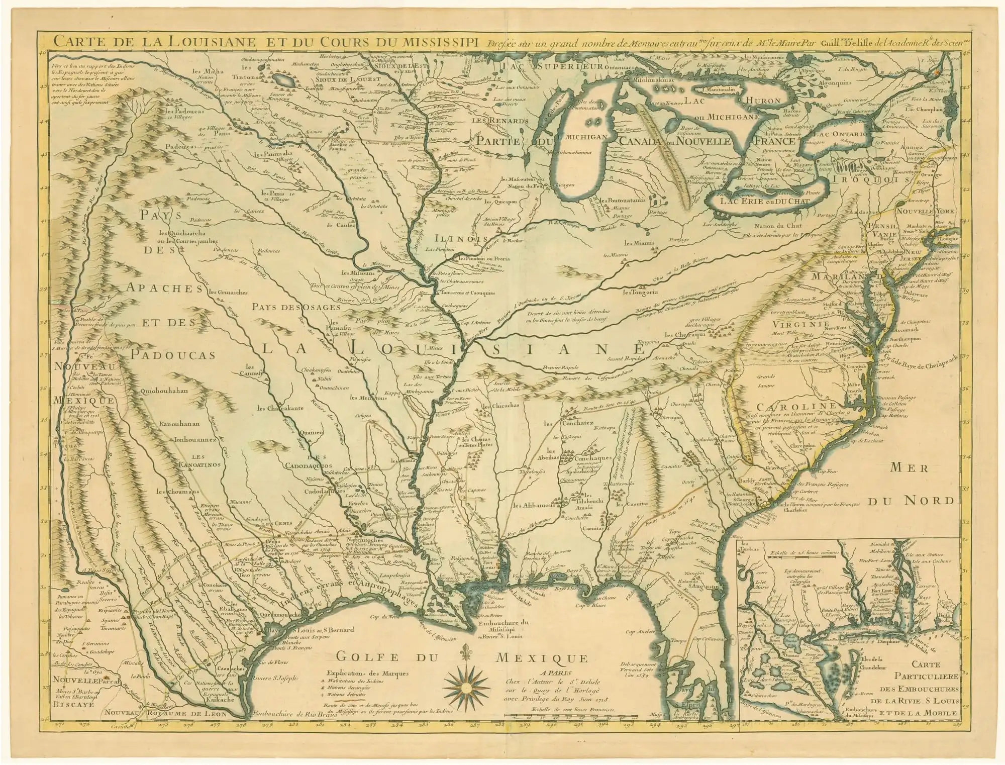
The map of Louisiane by Guillaume Delisle. Image from Dorothy Sloan Rare Books, Public Domain, Wikimedia Commons
"La Louisiane" was for the first time discovered by Spanish explorers in 1528 (190 years before this map was created). As soon as they lost their interest in the territory, French expeditions took the possibility, established their colonies from the Gulf of Mexico to the Great Lakes, and in 1682 named the region after King Louis XIV of France. The cartographer did know it all.
Now, look:
- the map centres on Louisiane and the Mississippi river as complete French territory, although French families were mainly settled along the Mississippi river (the closer to the Gulf, the more) and along the Gulf itself.
- English colonies on the right and Spanish colonies on the left look narrowed. The chain of the Appalachian Mountains (see yellow chain going from the centre to the upper right corner, the section which is aligned almost vertically) and the Rio Grande (see Embouchure Rio Bravo) are depicted as natural borders between the French and English or Spanish colonies, respectively. It was not the case, but the trick made the French territories look dominating, compared to their neighbours.
- Delisle added a brief explanation of the origin of the name of the Caroline region (to the right from Louisiane) – not central to the map, not under French control, the only region to be praised with such note. And the note says that it was named after the French king, Charles IX. The English authorities did not appreciate the remark as they were sure they had named it after their king Charles II. The issue resulted in the 15-year-long controversies.
Meanwhile, Spanish cartographers were actively producing their own maps to demonstrate their position regarding the territories they had under control.
The British Empire used another trick to demonstrate their power in the world – the oversized flags would make the British territories look way larger than they indeed were. Of course, it can be explained by the fact that the target audience were children and it is better for them to have key information zoomed in, but let's check the title. It's about power, not about territories.
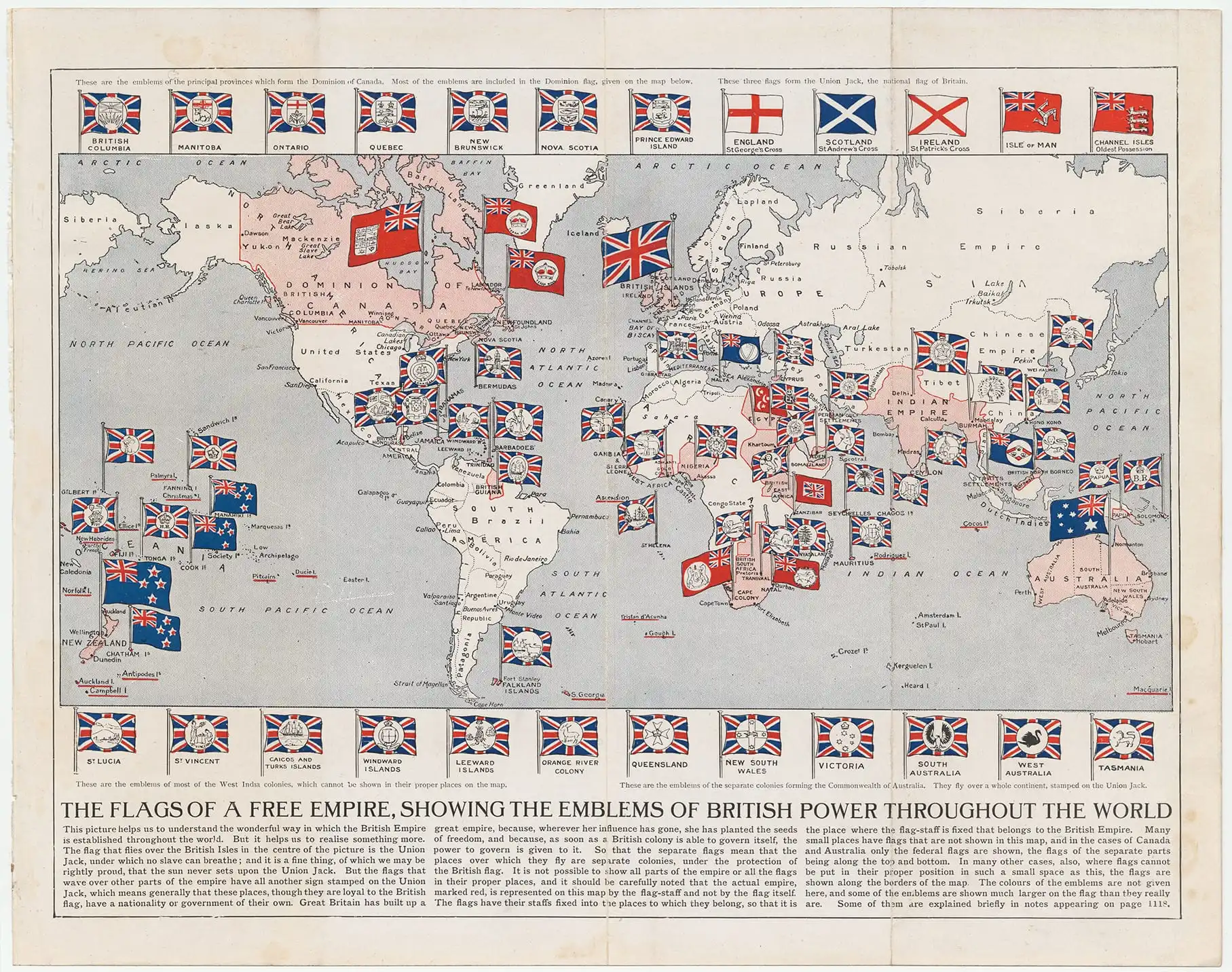
The map of the British Empire by Mees, Arthur, 1850-1923. Image by Mee, Arthur. 1910. The Childrens' Encyclopaedia. Vol. 2.Cornell University: Persuasive Cartography: The PJ Mode Collection, Public Domain, Wikimedia Commons
Allegorical maps also convey ideological ideas while speaking for themselves in a more explicit way.
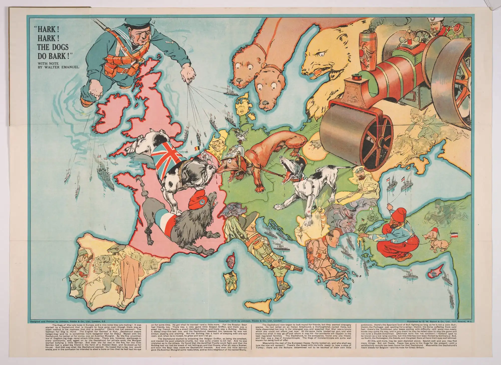
"Hark! Hark! The dogs do bark". The map by Johnson, Riddle & Co. - Cornell University: Persuasive Cartography: The PJ Mode Collection, Public Domain, Wikimedia Commons
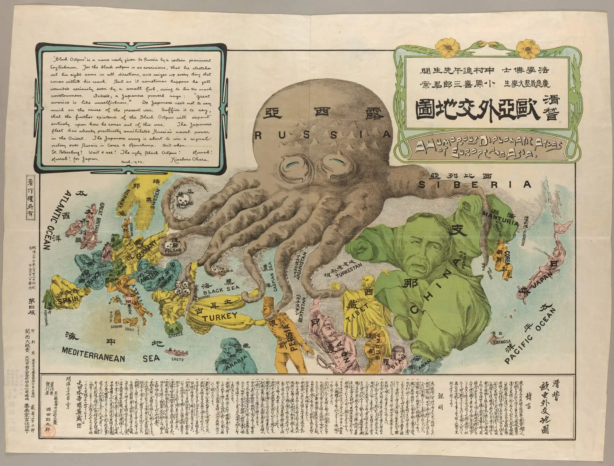
Europe and Asia Octopus Map by Ohara, Kisaburō. Image by Harmon 2004, 116-17 Cornell University: Persuasive Cartography: The PJ Mode Collection, Public Domain, Wikimedia Commons
Source of the map & its purpose
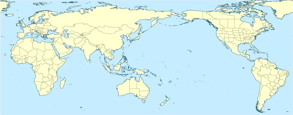
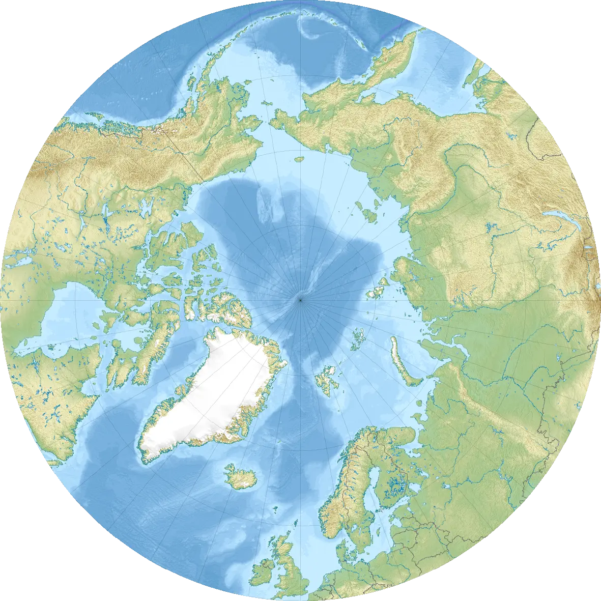
We are generally used to the world maps broken by the line of the Pacific Ocean which puts the USA and Russia on the opposite ends. However, this projection is not always the choice as it distorts the territories of the USA, Canada, Greenland, and Russia the most. And then, there are many who would like to be in the centre, since it is way easier to catch the reader's attention from there (remember the Delisle’s map). As a map-viewer though, you can always try to guess where a map comes from and what it aims to tell you.
From left to right:
1 - The Americas-centred map by Eric Gaba (Sting) - Tectonic plates (empty).svg created by ©Ævar Arnfjörð Bjarmason under PD and based on an USGS map, Public Domain, Wikimedia Commons.
2 - The Pacific-centred map by ©John Tann using:QGISInkscape - CC BY 4.0, Wikimedia Commons.
3 - The Arctic-centred map by ©Uwe Dedering - Own work, CC BY-SA 3.0, Wikimedia Commons
A few life lessons
- Each map is unique and was created for a specific purpose. For the best result, it is recommended to find the most appropriate version.
- Chances are we think we know how something really looks like or how a map (or any other tool) works when we are just not aware of the mistakes.
- The longer we take something for granted, without questioning it, the more chances there are it will be viewed as correct, even when it is not.
- The faster we react to accidental inaccuracies or purposeful biases, the more likely they will not be fixed as a single truth.