Who made Greenland look “fattish” and who else was affected?
First, how big is Greenland and why do we say it looks somewhat fat? Greenland’s exact area is 2,166,086 km2 which puts it in between Saudi Arabia and Algeria when compared by land area – none of these countries possesses lakes, reservoirs, or rivers within international boundaries and coastlines.
When checking the world map, you will likely see the huge island of Greenland comparable to the whole continents of Africa or South America rather than to separate countries.🤔
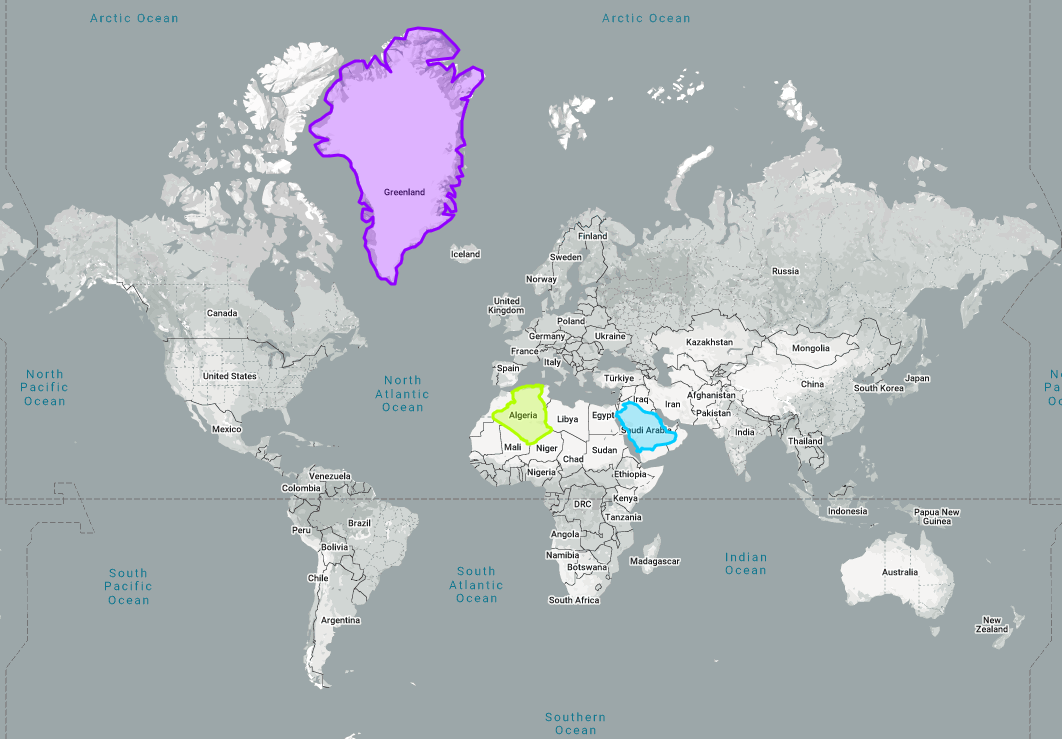
The image from thetruesize.com
This is the result of the map projection presented more 450 years ago being still in use. Known as Mercator’s projection, it is widely used for both digital and printed maps as it preserves the sizes and locations of little objects like streets and buildings – exactly what we look for on daily basis. Together with that, though, Mercator’s projection distorts the landmasses (the closer to the poles, the more) and makes all territories lying higher than Iceland look several times larger than they really are.
Check the map above once again: according to the measurements, Madagascar is in fact two times bigger than the United Kingdom, and Iceland must fit in Madagascar’s area five times. Would you ever tell it from the image?
Mercator is not his given name. Nor a surname!
Mercator’s projection was presented for the first time by a Flemish scholar in his late 50s. His intention was to make a flat map which would perfectly suit sailors’ needs by keeping nautical routes precise and readable. Thus, he kept these as straight lines, allowing deformation of land territories.
The man’s name was Geert or Gerard (de) Kremer and he was then living in Duisburg (25 km from Essen and 28 km from Düsseldorf, modern-day Germany). Since his adolescent years, he had been presenting himself as Gerardus Mercator Rupelmundanus , which was a translation of his real name to Latin – Gerardus from Geert, Mercator from Kremer which means "merchant", Rupelmundanus corresponding to "of Rupelmonde", a small village close to Antwerp where the man was born. He spent his school years studying in Latin, so a translated name was a normal thing. He just liked it enough to adopt for the rest of his life and made it a commonly known one.
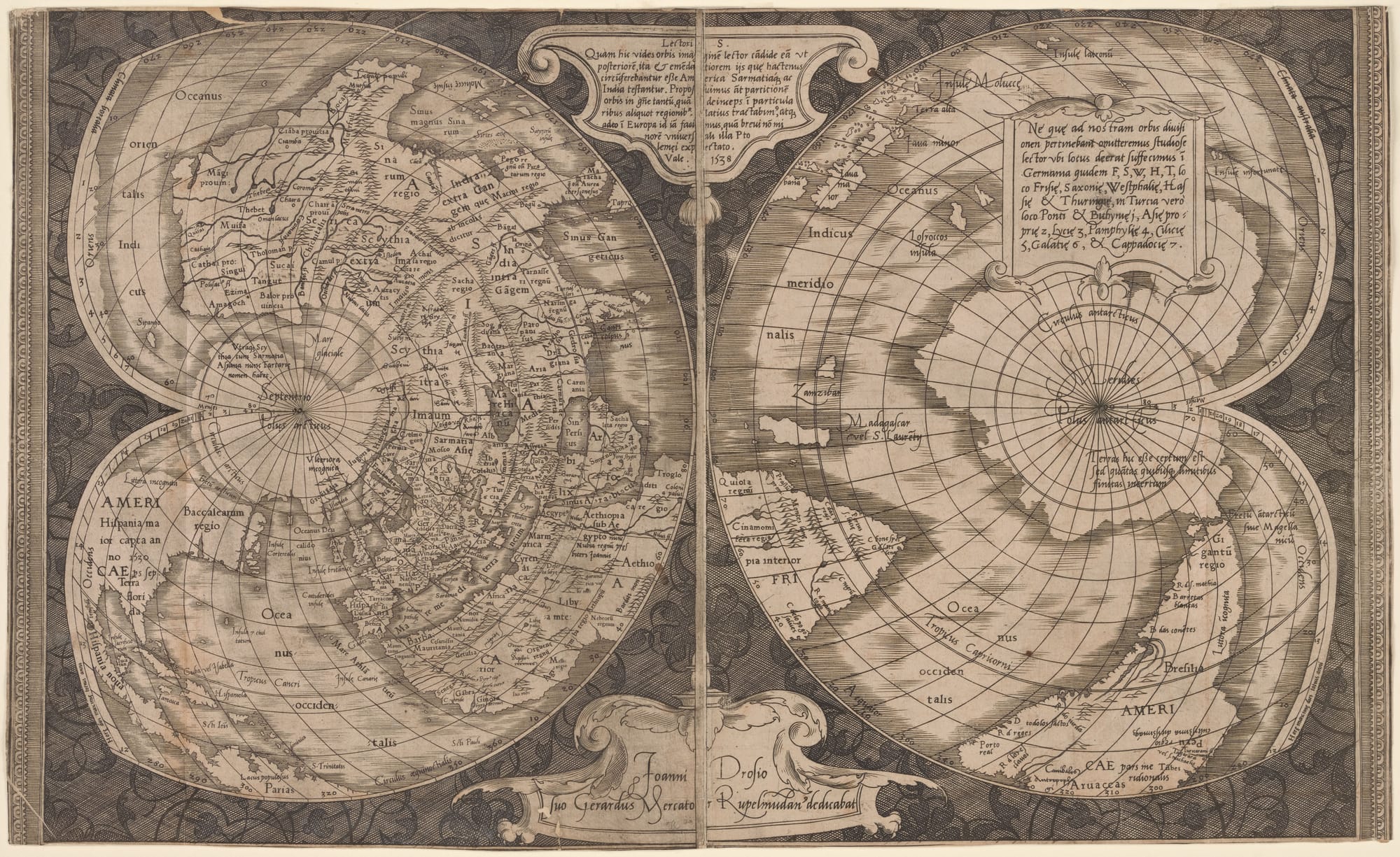
Mercator's first map of the world, 1538. Image by New York Public Library, Digital Collections, Public Domain, Wikimedia Commons
Also in the story
- what places did Mercator visit and how did he put on the map those he had never been to?
- how did Mercator earn his living and what was his most unusual work like?
- what did Mercator do wrong so that he ended up in a prison?
- did Mercator get any appreciation during his lifetime?
Read full story
Change the way you see the world (and not only😉)
The True Size Of – an interactive map which allows to visually compare real sizes of the countries
Extended geographic projections – 95 other than Mercator’s projections of the Earth
Projection Face – 63 map-making projections applied to represent a human’s face